Map A List Of Addresses
May 08, 2023
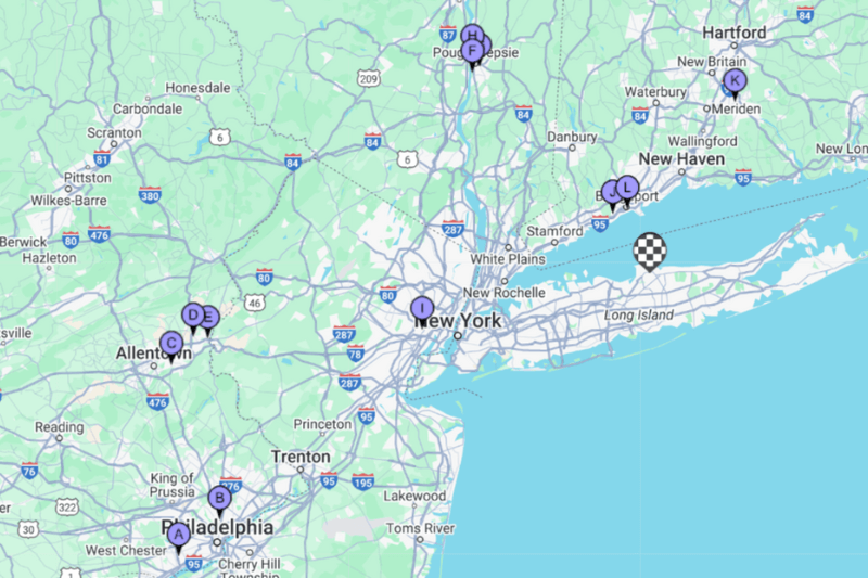
Want to map a list of addresses that’s hundreds of clients long?
No problem. Due to the amount of time, staff resources, and one too many headaches that manually completing this task requires; this is one of MyRouteOnline’s most popular features. To really get the most out of the app, not only do you want to map out several locations at once, but you’ll want to automatically import your list of locations, all with the click of a button. Imagine having to manually enter every single one of your clients into a new system one at a time; that doesn’t scream efficiency at all, does it?
We’ll get more into how to import your client details shortly, but for now, here are a few ins and outs of how the app works and how to best use it if you want to map a list of addresses.
Geocoding
If you’ve never heard of this term, not to worry. Geocoding merely explains how MyRouteOnline starts to plan routes by first determining their geographical location. Once you import your lists, the app will sort each address in three colors: green, red, and yellow. Green means the app has successfully found the address, and you’re good to go. Yellow means the app has found the general location of the address, but the specific location cannot be found, and you can edit the address to help the program locate it. Red means the system has not found a location for this address and you should fix that. Usually, it simply means that you need to enter further details for this address or that there is a typo or minor error. Alternatively, you can insert the GPS coordinates.
Choose your optimization
The MyRouteOnline app is automatically set to find the quickest route between any two points within your imported list. There are further details that you can enter to help the app provide a deeper understanding of your given situation, such as your departure time, mode of transport, and vehicle size. You can even enter a rough estimate of how long you expect to be idling at your stops. Moreover, you can switch the desired priority from time to distance or strike a balance between the two.
Required route mapping time
Once all the geocodes are located, the app analyzes every possible route between each location – which can be a lot of work. If your list of addresses is shorter, it will only take the app a few seconds to determine the best route. However, if your list is hundreds of addresses long, it will take longer for the app to determine the most efficient route. Here’s a peek at the types of routing times you can expect:
More details can be found in this blog about planning more than 100 addresses at once.
How to import your lists of addresses
Efficiency is the name of the game here, so you’ll want to avoid manually entering your list of addresses and instead import a complete list of addresses. However, if you face minor difficulties, don’t worry. For the most part, we have found that these hurdles can easily be troubleshot. Let’s take a look at an example…
Let’s say you want to map out a list of addresses using your client contact detail form. And you want to do it as efficiently as possible, so you decide to import your list directly into the app (as opposed to manually entering the addresses). However, once you attempt to import it, you receive a notification that it failed. So the first thing you should do here is to ensure that the file you’re importing is set up correctly. In some cases, app users have all their client details in one field (name, address, industry, notes, etc.). In situations like this, the app cannot register which details are an address and which are not; ensure that each element is in a separate field that can be read and understood.
MyRouteOnline makes it easy to map out several locations at once and find the most efficient route! Just follow these simple steps!
FAQ:
Question: Can I efficiently map lots of addresses at once using MyRouteOnline?
Question: Can I efficiently map lots of addresses at once using MyRouteOnline?
Answer: Yes! MyRouteOnline is the epitome of efficiency and can seamlessly map several locations in a single route in minutes (or even seconds!). MyRouteOnline removes the phase of painstakingly entering each address individually. Instead, you can import a master list of your required addresses, and the app will create a route map for several addresses.
Question: What exactly is geocoding, and how is it relevant to my route journey?
Answer: Gecoding is simply a process that MyRouteOnline uses to help create a map list of locations for you. You don’t need to know how it works or have any real interaction with it; it’s more of an internal tool that MyRouteOnline uses to categorize the geographical location of your addresses. The way that you will see it present within the app is via color. MyRouteOnline categorizes your address into one of three colors: red, yellow, and green. Green means the app has successfully found the address, yellow means it has found a rough location but needs further information, and red means the system could not find it. On the rare occasion when red appears within the app, it often means that a spelling error or typo is prohibiting the app from finding the correct address.
Question: How does MyRouteOnline optimize a route map for several addresses?
Answer: MyRouteOnline will craft an optimized, personalized route for you based on the personal preferences you have entered. The app will swiftly find the best possible way to get you to each of your locations in the most systematic way. That is, limiting or eliminating the need to back-track, drive on the same road multiple times, take the long route, and drive in dense traffic areas. You can further optimize this process by entering additional information into the app, such as mode of transport, vehicle size, departure time, and an estimated “idle time” for each stop.
Question: How long does it take to map several addresses at once?
Answer: MyRouteOnline can formulate optimized routes for up to 1,000 stops. Generally, the more stops required, the longer it will take to design a route. It depends on how many stops you have to make. For lists of around 10 addresses, it can take roughly 10 seconds. For lists of approximately 100 addresses, it can take roughly 7 minutes. And if you require more stops, it will take longer. Just don’t leave it to the last second; you’ll find it still saves you plenty of time!
